
Artikler og blogs
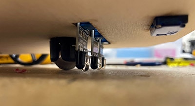
 Apply Advances in Sensing, Connectivity, and Motion Control Devices for Smarter Fixed-in-Place Robots
Publish Date: 2025-11-18
Apply Advances in Sensing, Connectivity, and Motion Control Devices for Smarter Fixed-in-Place Robots
Publish Date: 2025-11-18
Design precise yet flexible fixed-in-place robotics using advanced control, imaging, sensing, and communications technologies.
 Compact Multiband Patch Antenna Simplifies Design of RF Front-End for GNSS Receivers
Publish Date: 2025-10-23
Compact Multiband Patch Antenna Simplifies Design of RF Front-End for GNSS Receivers
Publish Date: 2025-10-23
To handle multiple satellite constellation frequency bands, a GNSS receiver employs a multiband antenna to realize higher accuracy and reliability.
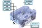 Enhance Autonomous Robot Localization Precision with Advanced IMUs and Sensor Fusion
Publish Date: 2025-10-01
Enhance Autonomous Robot Localization Precision with Advanced IMUs and Sensor Fusion
Publish Date: 2025-10-01
Combine advanced IMUs and other sensor types with sensor fusion for precise autonomous mobile robot (AMR) navigation in challenging environments.
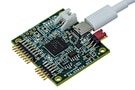
 Use a Kit to Develop GNSS-based Precision Positioning Applications Quickly
A GNSS module and associated development resources offer a path to rapid deployment of centimeter-scale precision positioning in diverse applications.
 Antenna’s Innovative Materials and Design Solves the Multiband GNSS Dilemma
Use a compact dual-band (L1/L5) patch antenna for GNSS receivers to reduce size without compromising performance.
 Understanding The Role of Drivers, Switches, and Laser Diodes for Effective LiDAR Performance
Publish Date: 2025-02-06
Understanding The Role of Drivers, Switches, and Laser Diodes for Effective LiDAR Performance
Publish Date: 2025-02-06
Electro-optical components are at the core of LiDAR, which uses laser pulses to create a three-dimensional “point cloud” rendition of the surroundings.
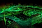
 What is LiDAR-Light Detection And Ranging?
Learn how LiDAR technology is used to measure distances with precision, and discover its applications in fields like autonomous vehicles and mapping.
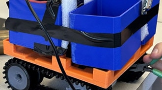 Robot Beehive Mover
Learn how a team of engineering students designed and built a robot beehive mover, complete with GPS, Bluetooth, and PCB design using OrCAD.
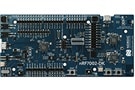
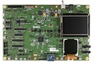 Developing Edge AI Applications with ADI's MAX78002 MCU
Learn how the ADI 78002 MCU can support the design of edge AI applications with low power consumption, high performance, and robust security features.
 Styring af plæneklipperflåden med iWave Telematics-løsninger
Publish Date: 2024-08-22
Styring af plæneklipperflåden med iWave Telematics-løsninger
Publish Date: 2024-08-22
Med telematik kan plæneklippere give flådeadministratorer løsninger til at overvåge og styre hele deres flåde, herunder køretøjer, førere og aktiver.
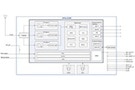
 Integrated Time-to-Digital Converters Simplify Time-of-Flight Range-Finding Designs
Use integrated time-to-digital converters to simplify time-of-flight measurements for radar, lidar, sonar, and flow meters.
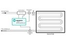
 Wi-fi®-komponenter for positionsbestemmelse overvinder GNSS- og huller i mobilnetværket
Publish Date: 2024-08-07
Wi-fi®-komponenter for positionsbestemmelse overvinder GNSS- og huller i mobilnetværket
Publish Date: 2024-08-07
Energieffektive Wi-fi®-følge-integreret kredsløb kan overvinde begrænsninger i GNSS- og mobilenheders ydeevne med geografisk positionering af høj nøjagtighed.
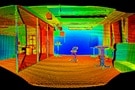
 SLAM from an Algorithmic Point of View (Part 2)
A discussion of the three primary techniques used in SLAM algorithms to create maps of unknown areas for robot navigation.
 SLAM: How Robots Navigate the Unknown Terrain
The concept of Simultaneous Localization and Mapping (SLAM) is discussed along with how to incorporate it into your application.
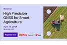 Webinar – High-Precision GNSS for Smart Agriculture
Smart agriculture GNSS improves with resolutions reaching the centimeter level for position accuracy and Real-Time Kinematics which corrects common GNSS errors.
 Sådan implementeres pålidelige flynavigationssystemer omkostningseffektivt med præcisionskomponenter
Publish Date: 2024-04-11
Sådan implementeres pålidelige flynavigationssystemer omkostningseffektivt med præcisionskomponenter
Publish Date: 2024-04-11
Udviklere kan bruge præcisionsdataindsamlingsmoduler og højt integrerede IMU'er til at implementere sofistikerede og omkostningseffektive flyelektroniksystemer.
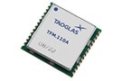 Simplifying GNSS Product Development on the Front End
Discover how to enhance design for autonomous tech with breakthrough GNSS modules from Taoglas, a company whose antennas are aiding Ireland's first satellite.
 Hurtig guide til GaN FET'er til LiDAR i selvkørende køretøjer
Publish Date: 2024-02-01
Hurtig guide til GaN FET'er til LiDAR i selvkørende køretøjer
Publish Date: 2024-02-01
Brug GaN FET'er til at drive højeffektive nanosekund-laserpulser i LiDAR-systemer til biler, der opfylder IEC 60825-1 klasse 1 sikkerhed.
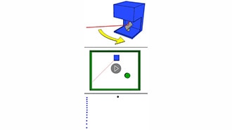
 Basic Motion Sensors: Ultrasonic and IR
Ultrasonic or IR? Learn the strengths and weaknesses of these sensors, from detection range to cost. Make an informed decision for your next endeavor.
 Webinar – Simplify GNSS Designs Using Modules
Understand the complexities of GNSS systems in automotive, consumer and industrial applications with the help of STMicroelectronics’ product marketing experts.